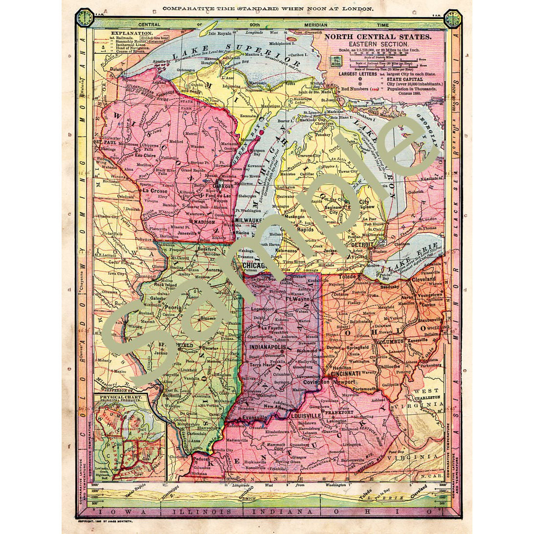
Printable Antique 1885 Color Map of Wisconsin Michigan Illinois Indiana Ohio Kentucky
$ 2.95
Instant download. Printable Antique 1885 Color map of Wisconsin, Michigan, Illinois, Indiana, Ohio, and Kentucky. Scanned at 300 dpi. Has all the old characteristics still, to add to its charm.
This file prints at 8.75” wide x 11.25” tall, but may be re-sized and printed as many times as you like. The watermark will not appear on the image you receive.
By purchasing this sheet you agree to the following terms:
You may use this sheet for art projects to sell, such as cards, gift tags, jewelry, etc, and personal projects. Please do not redistribute in original form, in digital form, or printed format or make it available for download to anyone else.
Upon confirmation of payment you will receive an email email letting you know your files are ready to download.
Scanned from Antique map in my personal collection. Thank you!
Related Items

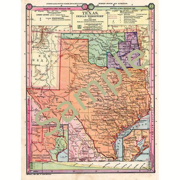
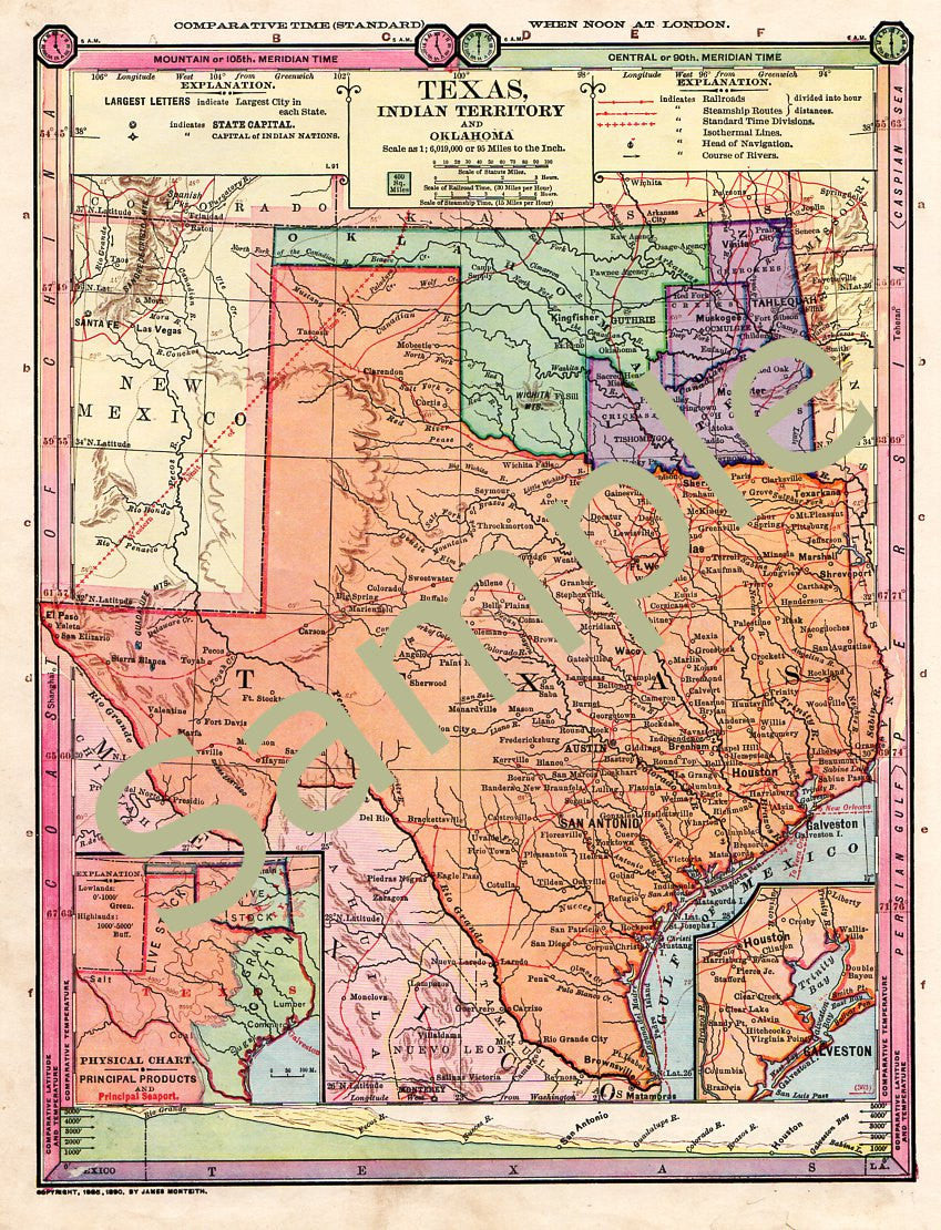
Antique 1885 Color Printable Map of Texas Oklahoma Indian Territory Instant Download 1880s Color Cartography
$ 2.95
Instant download. Digital 1885 Antique printable color map of Texas, Oklahoma, and Indian Territory. Scanned at 300 dpi. Has all the old characteristics still, to add to its charm.
This file prints at 8.75” wide x 11.25” tall, but may be re-sized and printed as many times as you like. The watermark will not appear on the image you receive.
By purchasing this sheet you agree to the following terms:
You may use this sheet for art projects to sell, such as cards, gift tags, jewelry, etc, and personal projects. Please do not redistribute in original form, in digital form, or printed format or make it available for download to anyone else.
Upon confirmation of payment you will receive an email email letting you know your files are ready to download.
Scanned from an Antique map in my personal collection.

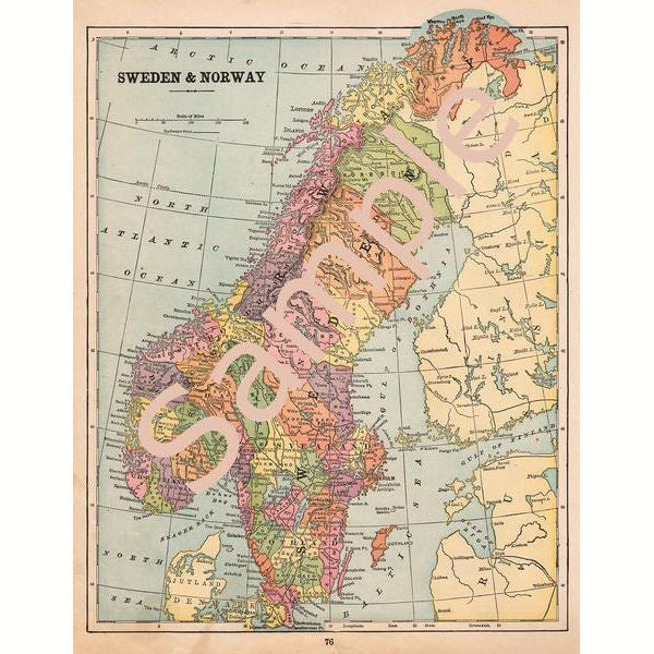
Antique 1900 Printable Map of Sweden and Norway Color Illustration Digital File
$ 2.95
Instant download. Digital 1900 Antique printable map of Sweden and Norway. Scanned at 300 dpi. Has all the old characteristics still, which only adds to its charm.
This file prints at 9.75” wide x 12.5” tall, but may be re-sized and printed as many times as you like. The watermark will not appear on the image you receive.
By purchasing this sheet you agree to the following terms:
You may use this sheet for art projects to sell, such as cards, gift tags, jewelry, etc, and personal projects. Please do not redistribute in original form, in digital form, or printed format or make it available for download to anyone else.
Upon confirmation of payment you will receive an email email letting you know your files are ready to download.
Scanned from Antique map in my personal collection. Thank you!

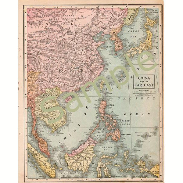
Printable Antique 1899 Map of China Instant Digital Download
$ 2.95
Instant download. Digital 1899 Antique map of China and the Far East. Scanned at 300 dpi.
Upon confirmation of payment you will receive an email email letting you know your file is ready to download.
This file prints at 10 1/4” wide x 13 3/8” tall, but may be re-sized and printed as many times as you like. The watermark will not appear on the image you receive.
By purchasing this sheet you agree to the following terms:
You may use this sheet for art projects to sell, such as cards, gift tags, jewelry, etc, and personal projects. Please do not redistribute in original form, in digital form, or printed format or make it available for download to anyone else.
Scanned from Antique map in my personal collection. Thank you!
© 2025 Avid Vintage. Powered by Shopify